
A long-planned Army Corps of Engineers’ project to dredge a segment of the Willamette River gets under way soon. Later this month, the Corps will begin dredging sand and sediment that have accumulated in an area of the river called Post Office Bar. Located about two miles south of the Willamette’s confluence with the Columbia River, Post Office Bar is a tricky navigation point for river pilots, and the accumulated sediment on the river bottom is a navigation hazard.
Dredging is scheduled to last no more than 31 days and will take place while fish are least likely to be migrating through the river. Dredged sand and sediment will be placed at the Port’s West Hayden Island dredge material placement facility. This 105-acre site on the north side of the island was developed to manage dredge material long-term. It’s protected by berms, and material is placed there only after a careful and conservative review by environmental regulators.
Contractors working on behalf of the Corps will transport material from a barge anchored just off-shore of Hayden Island. Over the course of the month, they’ll pipe about 45,000 cubic yards of sand and sediment into the upland area. While the Port-owned property is not open to the public, anyone accessing the island should avoid the active work areas, especially areas inside the berms where material is being deposited. This area is marked by signs warning of the unstable nature of newly-placed wet sand and soil.
The beach on Hayden Island is open to everyone, and contractors are required to have a clearly-marked walkway over the pipe to maintain beach access. Have questions or comments? Email Rachel Wray or call 503.415-6047.
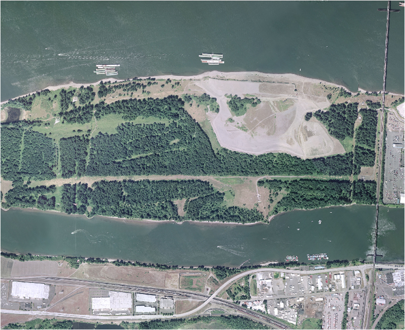
Shown above: the dredge material placement site on West Hayden Island is an open, sandy area on
the north side of the island.